Project
Community
News
My App
My maps
Maps of Důl
Advanced search
All
Private
Favorites
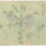
Okolí Novo-Cerekvické, na 2 hod. cesty
1850|Pavlík
Umgebungen von Tabor
1869
II. vojenské mapování 16
1871
1:144 000
Umgebungen von Tabor
1869
Czaslauer Kreis
1800|Peter franza [sic]
1:240 000
Czaslauer Kreis
1830|Marco Berra
1:192 000
Czaslauer Kreis
1800|Peter franza [sic]
1:240 000
1600
1650
1700
1750
1800
1850
1900
1950
2000
History
Old maps of Důl
Discover the past of Důl on historical maps
Old maps of Důl
Discover the past of Důl on historical maps
Explore Maps
Discover History
Parent places
Pacov
Related places
© MapTiler
© OpenStreetMap
 1850|Pavlík
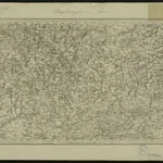 1869
1869
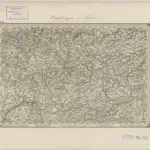 18711:144 000
 1869
1869
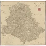 1800|Peter franza [sic]1:240 000
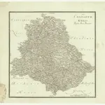 1830|Marco Berra1:192 000
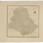 1800|Peter franza [sic]1:240 000