Project
Community
News
My App
My maps
Maps of Slezské Rudoltice
Advanced search
All
Private
Favorites
II. vojenské mapování 2
1870
1:144 000
Umgebungen von Jägerndorf
1846
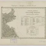
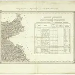
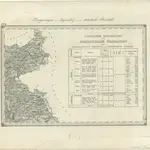
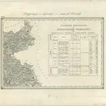
Umgebungen von Jägerndorf und die statistische Übersicht
1869|Kiss, Josef
1:144 000
Special Karte der Markgrafschaft Maehren, mit den Antheilen des Herzogthums Schlesien
1844|[S.n.]
Special Karte der Markgrafschaft Maehren, mit den Antheilen des Herzogthums Schlesien
1844|[S.n.]
Umgebungen von Jägerndorf und die statistische Übersicht
1869|Kiss, Josef
1:144 000
II. vojenské mapování 2
1872
1:144 000
1600
1650
1700
1750
1800
1850
1900
1950
2000
History
Old maps of Slezské Rudoltice
Discover the past of Slezské Rudoltice on historical maps
Old maps of Slezské Rudoltice
Discover the past of Slezské Rudoltice on historical maps
Explore Maps
Discover History
Parent places
Bruntál District
Related places
© MapTiler
© OpenStreetMap
 18701:144 000
 1846
1846
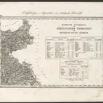 1869|Kiss, Josef1:144 000
 1844|[S.n.]
 1844|[S.n.]
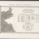 1869|Kiss, Josef1:144 000
 18721:144 000